
Wanderung Geissberg 25.08.2020
Wanderung rund um Geissberg mit interessanten Einblicken in den riesigen Steinbruch Gabenchopf.
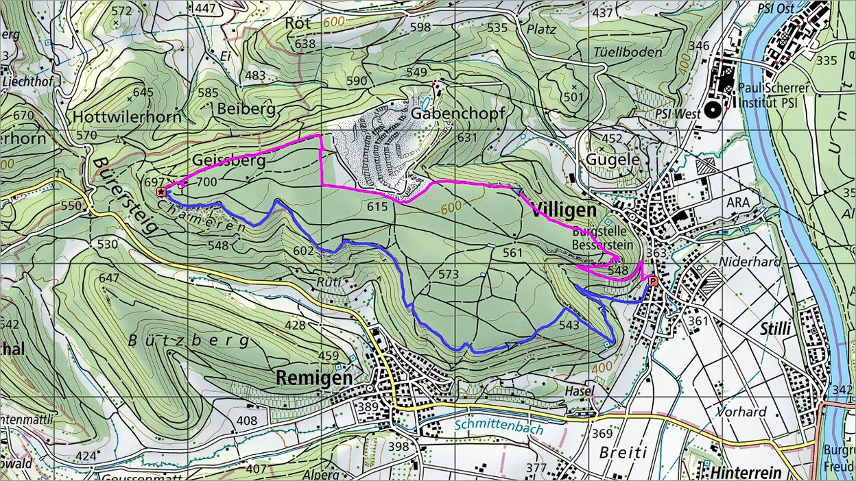 Die Route |
 2 of 26 Treppen zur Ruine Besserstein  Treppen zur Ruine Besserstein |
 3 of 26 Blick vom Aussichtsplattform Besserstein Richtung PSI Blick vom Aussichtsplattform Besserstein Richtung PSI |
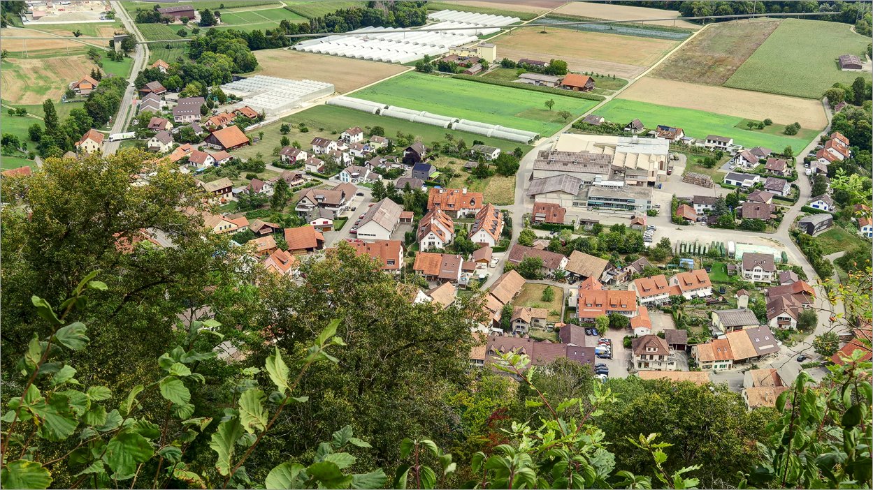 4 of 26 Villigen Villigen |
 5 of 26 Siggenthal Station und Holcim-Fabrik Siggenthal Station und Holcim-Fabrik |
 6 of 26 Blick Richtung Brugg-Baden Blick Richtung Brugg-Baden |
 7 of 26 Artilleriewerk Besserstein Artilleriewerk Besserstein |
 8 of 26 |
 9 of 26 Meistens die Route verläuft auf dem bequemen Wanderweg im Wald Meistens die Route verläuft auf dem bequemen Wanderweg im Wald |
 10 of 26 |
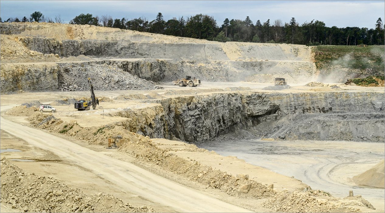
 11 of 26 Steinbruch Gabenchopf Steinbruch Gabenchopf |
 12 of 26 |
 13 of 26 |
 14 of 26 |
 15 of 26 |
 16 of 26 |
 17 of 26 |
 18 of 26 Der Dampf von Leibstadt Der Dampf von Leibstadt |
 19 of 26 Mächtiger Funkturm Mächtiger Funkturm |
 20 of 26 |
 21 of 26 |
 22 of 26 |
 23 of 26 |
 24 of 26 |
 25 of 26 |
 26 of 26 Aussichtsplattform und Ruine Besserstein Aussichtsplattform und Ruine Besserstein |
Datum
25.08.2020Ausgangspunkt
VilligenZiel
Geissberg (700m), ► siehe auf der Karte .Koordinaten
WGS 84 (lat/lon): 47.53068, 8.17067CH1903 / LV03: 655`124.58, 264`695.16
Region
Kt. Aargau, VilligenRoute
► Siehe GPS Track auf Topo-Karte.Magenta: Hin; Blau: Zurück.
Hoehenmeter
ca. 340mStrecke
11.5kmSchwierigkeit
T2Herunterladen
► GPS Track als kml-File (mit rechten Maustaste "Save Link/Target as").Sonstiges
Geissberg in Wikipedia:Als Geissberg wird ein Berg im Aargauer Jura bezeichnet. Der Berg gehört zum Tafeljura, das Plateau ist bewaldet. Charakteristisch ist der Chamere Fels, eine rund 200 Meter breite Felswand, welche dem Geissberg einen speziellen Charakter verleiht. Der höchste Punkt liegt auf rund 700 m ü. M.